Pennsylvania Hardiness Zones: Finding Your Town on the Map
If you are choosing perennials, shrubs, or trees in Pennsylvania, a hardiness zone can help you avoid plants unlikely to survive winter. But the map does not tell you when to sow seeds or whether a late frost will damage new growth. Here is how to find the zone for your town, interpret it, and use it alongside the local conditions that matter in a real garden.
What a Pennsylvania hardiness zone tells you
The USDA Plant Hardiness Zone Map groups areas by their average annual extreme minimum winter temperature. It is designed to help gardeners assess whether a plant is likely to survive the coldest part of winter in a particular area.
The map uses numbered zones, with each zone covering a 10°F temperature band. Each zone is divided into “a” and “b” subzones, which represent 5°F increments within that band. A lower zone number indicates colder average winter lows; a higher number indicates milder ones. Pennsylvania zone references span from northern 5b to southeastern 8a, but that statewide range should not be used to assign a zone to a particular town or property.
A zone is a useful starting point, not a promise. A plant labeled for a zone may survive winter in a suitable site, yet struggle in a wet, exposed, or poorly drained spot. Conversely, a sheltered yard may offer better conditions than its broader map area suggests. The map describes a climate pattern across an area, not the exact temperatures every garden experiences.
The zone system is also about winter survival, not every aspect of plant performance. It can help you judge whether a perennial or woody plant is likely to withstand typical cold extremes, but it does not tell you whether that plant will thrive in your soil, tolerate summer heat, flower reliably, or produce fruit. For a fuller explanation of the map’s purpose and limits, see The Pennsylvania Plant Hardiness Zone Guide: What Zones Mean.
| What the zone map helps with | What it does not tell you |
|---|---|
| Whether a plant is broadly suited to typical winter lows in an area | The exact coldest temperature your yard will reach |
| Comparing the winter hardiness of plants | When the last spring frost will occur |
| Narrowing down choices for perennials, shrubs, and trees | Whether a plant has the right sun, soil, moisture, and drainage |
| Flagging plants that may be marginal in winter | Whether tender new growth will survive a sudden cold snap |
| Making a first pass at plant selection | How much protection a particular site or plant will need |
When a nursery label gives a hardiness range, compare it with the zone shown for your location. If the lowest zone number on the label is higher than the zone for your area, the plant may be at risk from winter cold. If it is within or below your zone, it may be a reasonable candidate, but its growing requirements still need to match your site.
For more context on labels and plant purchases, Understanding USDA Plant Hardiness Zones When Buying Perennials explains how to read a rating without treating it as a guarantee.
How to find your town on the USDA map
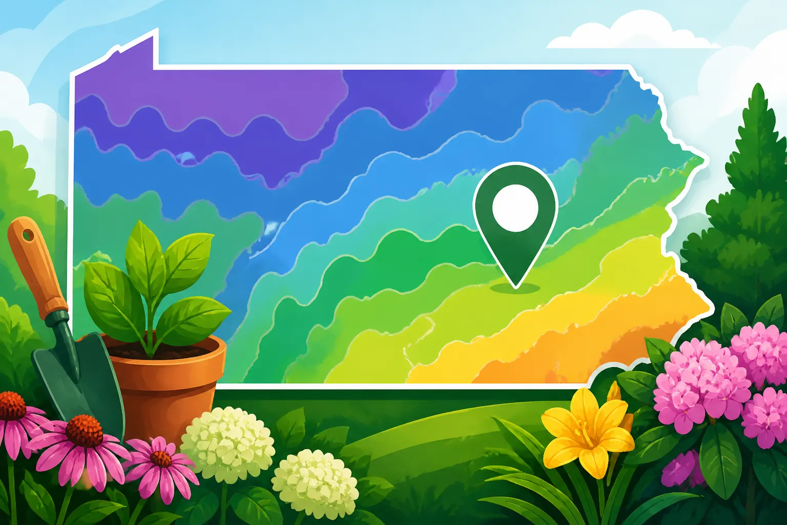
The simplest way to locate your area is to use the official USDA Plant Hardiness Zone Map. Search for the official map by name, then use its location search if available or navigate to your part of Pennsylvania on the map. You can also use How to Look Up Your Pennsylvania ZIP Code on the USDA Zone Map for a step-by-step look-up approach.
A ZIP code is a convenient way to get started, but it is not a precise description of every yard within that code. ZIP code boundaries are built for mail delivery, while hardiness zones follow climate patterns. A ZIP code may cover more than one landscape type, and a zone boundary may cut across part of it. Treat a ZIP-based result as a useful regional clue, then look closely at the map around your town.
A practical lookup process
- Search the official map by ZIP code or place name. If the map provides a search box, try the town name first. If that does not return a clear location, try a nearby ZIP code.
- Check where the result sits on the map. Make sure the map has located the Pennsylvania town you intended, especially if a place name is shared elsewhere.
- Read the zone label, including its letter. Record both the number and the a or b subzone if one is shown. The subzone gives a more specific part of the temperature band.
- Zoom out and inspect the surrounding colors. Look for nearby zone boundaries and consider whether the town sits near a change in elevation, a valley, or a more exposed area.
- Compare the map result with the growing conditions in your own yard. A map result is a broad baseline. It cannot account for every slope, courtyard, wall, or low spot.
If the map places your town near a color boundary, do not assume that a small shift on the map corresponds to an equally sharp change in your garden. Map boundaries mark transitions in a regional climate dataset. They are useful for organizing information, but local temperatures can vary gradually and unevenly.
Some Pennsylvania counties or ZIP codes may include more than one zone. In those situations, the map location matters more than the county name alone. A county-wide label can hide differences between high ground and lower terrain, or between a cooler rural area and a warmer built-up neighborhood. Navigating Split Zone Boundaries Across Pennsylvania Counties offers more detail on interpreting these overlaps.
Town, ZIP code, or exact property?
A town name is often a good way to orient yourself, but it does not identify a single climate. Town boundaries can include neighborhoods at different elevations or with different exposure. A ZIP code covers a delivery area, not a uniform set of garden conditions. And a property’s temperature can be influenced by nearby landforms and structures.
That does not make the map unhelpful. It means the map is best used at the scale it was designed for: as a broad planning tool. Use it to screen plants and understand your regional winter pattern, not to make a claim about a specific address or an exact corner of a garden.
If two sources give slightly different zone information for your town, check that they are using the same version of the USDA map and the same location point. Also check whether one source reports only the numbered zone while another includes the a or b subzone. The map’s own location result is generally the clearest starting point for matching a plant label to an area.
Why nearby Pennsylvania gardens can have different conditions
A hardiness map cannot show every small temperature difference inside a town. Hills, valleys, slopes, pavement, buildings, water, and wind exposure all influence the conditions plants experience. These differences are often called microclimates.
In Pennsylvania, topography can matter as much as the general regional zone for a particular planting. Cold air tends to settle in low places on calm, clear nights, while a slope with good air movement may avoid some of that pooling. A south-facing wall can make a sheltered planting spot warmer than an open, windy area nearby. A shaded, damp corner may remain cool and wet even when the surrounding garden warms up.
These effects do not change the official zone shown on the map. Instead, they help explain why a plant may do better or worse than its zone rating alone would suggest. How Yard Microclimates Can Shift Your Planting Conditions can help you assess those site-level differences.
Common microclimate clues
- Low pockets and valley bottoms: These may collect cold air during some weather conditions. Plants that bloom early or break dormancy quickly may be more exposed to late cold there.
- Slopes: Air movement and slope direction can affect how warm or cold a planting area feels. An exposed slope can also face stronger winds and drying.
- Walls and paved surfaces: Masonry and pavement absorb and release heat, potentially making nearby spots warmer than open ground. The effect depends on exposure, shade, and the structure itself.
- Shade and tree cover: Shade can keep soil and air cooler, while tree roots may compete with nearby plants for water. A map does not indicate either condition.
- Wind exposure: Wind can increase stress on exposed plants and dry foliage or soil. A sheltered site may be more forgiving for a plant near the edge of its cold tolerance.
- Moisture and drainage: Wet soil can contribute to root problems, especially for plants that need well-drained conditions. A plant can be winter-hardy and still fail in a waterlogged spot.
A simple garden observation record can make these differences easier to use. Note which areas thaw first, where frost lingers, where snow tends to remain, and where plants show winter injury. Pay attention over more than one season, because a single winter or spring can be unusual.
If your garden has a low spot, a warm wall, or an exposed ridge, use that information to fine-tune your choices. Put the most cold-sensitive plants in the most sheltered suitable location, and reserve exposed or colder areas for plants with a comfortable hardiness margin. Do not rely on a microclimate to make a plant several zones less hardy suddenly dependable; small site advantages are not a substitute for an appropriate plant choice.
The map and your yard answer different questions
The map asks, “What winter minimum is typical for this broad area?” Your yard asks, “What conditions will this plant experience here?” A zone lookup is the first question. Site observation helps with the second.
That distinction is useful when a plant is close to the edge of its listed range. If its rating barely matches your map zone, a sheltered location with suitable soil may improve its chances. If it is rated for a substantially milder area, a warm wall may not be enough protection for reliable survival. The more costly or long-lived the plant, the more worthwhile it is to choose one with a comfortable margin rather than testing the limit.
Hardiness zones are not frost dates or planting dates
A common mistake is to use a hardiness zone as a spring planting calendar. The zone map does not tell you when it is safe to plant vegetables outdoors, when a late frost might occur, or how warm the soil is. It describes average annual extreme minimum winter temperatures, not the timing of spring weather.
A place can have a relatively mild winter zone and still experience a damaging spring frost. Likewise, a colder zone does not give you a precise date for starting seeds or transplanting vegetables. Spring weather varies from year to year, and elevation, valley position, and local exposure can shift conditions within a region.
For a deeper explanation of the distinction, see Why Hardiness Zones Measure Winter Lows, Not Spring Planting Dates and Hardiness Zones vs Frost Dates: When Can You Actually Plant?.
Use the right information for the decision
| Decision | Information to use |
|---|---|
| Will a perennial, shrub, or tree likely survive typical winter cold? | Its hardiness rating and the zone for your area |
| When should tender seedlings go outside? | Local frost benchmarks, current weather, and the crop’s temperature needs |
| When can seeds germinate reliably outdoors? | Soil temperature, soil moisture, and the seed’s requirements |
| Could a spring freeze damage emerging buds or blossoms? | Plant development stage and the forecast, not just the zone |
| Is a location unusually cold or warm? | Site observations and microclimate clues |
| Can a crop finish before autumn cold? | Days to maturity, local growing-season conditions, and frost risk |
Use frost-date references as estimates, not fixed appointments. Frost dates express probabilities for a station or area; they cannot promise what will happen in an individual year or yard. Pennsylvania’s terrain and local exposure make it especially useful to compare regional benchmarks with what you observe. For a planting decision, When Is It Safe to Plant in Pennsylvania? Last-Frost Benchmarks is more relevant than a hardiness zone alone.
Vegetable gardeners can also consult Pennsylvania Vegetable Sowing and Transplanting Calendar to plan crop timing. The zone can help describe winter conditions, but it should not replace sowing guidance, soil-temperature checks, or attention to the forecast.
Winter survival and spring injury are different risks
A plant can be hardy enough to survive winter yet vulnerable when it begins growing in spring. Buds, flowers, and new shoots may be damaged by a cold event after a mild spell encourages early growth. This is one reason a plant’s hardiness rating should not be treated as a guarantee of flowers or fruit every year.
The reverse can happen, too: a plant may survive winter but perform poorly because its site is too wet, too shaded, or too exposed. The zone answers a narrow but valuable question about cold tolerance. The broader planting decision needs other information.
Using the zone to choose plants
Once you have a likely zone for your town, use it as an initial filter. Read the plant label or catalog description for a hardiness range and check whether it includes your area. Then assess the rest of the plant’s needs: sun, soil type, drainage, moisture, mature size, and exposure.
For example, a plant rated for a range of zones may be a reasonable candidate if your location falls within that range. If your zone is at the cold edge of the recommendation, consider whether the site is sheltered and well-drained. If your zone is outside the listed range, think carefully before relying on a special microclimate to compensate. A marginal plant may require extra attention, and it may still be unreliable after a severe winter.
Read plant labels as a range, not a guarantee
A hardiness rating is a screening tool. It does not account for every plant’s age, health, planting depth, winter moisture, snow cover, or exposure. A newly planted specimen may be more vulnerable than an established one. Plants in containers can also experience colder root conditions than plants rooted in the ground, depending on the container and its setting.
When comparing plants, look for a rating that includes your zone rather than focusing only on the top end of the range. If a label lists zones that include both colder and warmer conditions, the plant is generally being presented as suitable across that span. Still, check whether the nursery is describing winter survival, flowering performance, or another trait. A hardy plant may live through winter but flower less reliably in a cooler area.
The lower end of a plant’s range deserves particular attention. If it is at the edge of your area’s hardiness, assess the planting site before buying. A well-drained, protected location may be more forgiving than an exposed, wet one. For plants that are expensive, large, or intended to form a permanent feature, a plant comfortably suited to the area is often the lower-risk choice.
Separate hardiness from other needs
A zone match does not establish that a plant is right for your garden. Before planting, check:
- Light: Full sun, part shade, or shade requirements need to match the site.
- Soil: Texture, acidity, fertility, and drainage affect establishment and growth.
- Water: Some plants need consistently moist conditions, while others struggle in saturated soil.
- Space: Mature height and spread matter near buildings, paths, and other plants.
- Pests and disease: A hardy plant may still be vulnerable to local problems.
- Season length: Plants grown for fruit or flowers may need enough time and suitable conditions to develop well.
If a plant’s description lists several requirements, use them together. A zone match paired with poor drainage is still a poor fit. A plant that needs full sun will not become suitable for deep shade just because it can tolerate winter cold.
Perennials, shrubs, and trees versus annual vegetables
Hardiness zones are most directly useful when choosing plants expected to remain outdoors through winter, such as many perennials, shrubs, and trees. They are less useful for deciding when to plant annual vegetables, which are usually managed around spring and autumn conditions.
Some vegetables are cool-season crops and tolerate cooler weather better than tender warm-season crops. Their sowing and transplanting windows depend on crop needs, soil conditions, and frost risk. The zone can provide regional context, but it does not determine those dates.
For fruit trees and other long-lived plants, winter hardiness is only one part of the choice. The site’s drainage, sunlight, air movement, and exposure during bloom can influence performance. A plant may survive winter but produce inconsistently if spring cold affects flowers. Consider both survival and the conditions needed for the plant to reach its intended purpose.
A practical way to combine the map with local knowledge
A reliable plant decision uses several kinds of information rather than asking one map to answer every question. Start broad, then get more specific.
- Find the zone for your town or nearby location. Use the official USDA Plant Hardiness Zone Map and note the full zone label.
- Check how close you are to a zone boundary. A result close to a boundary deserves a little more caution than one in the middle of a broad area of the same color.
- Read the plant’s hardiness range. Confirm that your zone falls within it, and notice if your area is at the cold edge.
- Assess the planting site. Look at slope, cold-air pooling, shade, wind, drainage, and nearby walls or pavement.
- Check the plant’s other needs. Confirm light, soil, moisture, and space requirements before buying or planting.
- Use frost and soil information for seasonal timing. For sowing and transplanting, consult relevant calendar guidance and local conditions rather than relying on the zone.
- Keep notes on outcomes. Record winter injury, spring growth, and where plants did well. Your own observations can help refine future choices.
This process is especially helpful when a plant sits near the edge of its hardiness range. Instead of treating the map as a yes-or-no verdict, use it to identify where you may need to be more selective. A plant rated for colder conditions than your location may have a better margin of winter reliability, while a plant at the edge of its rating may call for a protected spot and careful attention to drainage.
What to do when sources disagree
A disagreement does not always mean one source is wrong. Check whether each source refers to the same location, uses the full zone including its letter, or is reporting a broad county range instead of a point on the map. The location selected on a map can matter if a town covers varied terrain.
Also check what question each source is answering. A plant nursery may report a plant’s rated hardiness. A map gives a climate zone. A planting calendar gives seasonal timing. Those are related, but they are not interchangeable.
If you cannot confidently tell which zone applies to a particular part of town, avoid over-interpreting a boundary. Use the map to narrow the likely conditions, then choose plants with a suitable hardiness range and confirm their site requirements. If the plant is valuable or difficult to replace, choosing one with more cold tolerance is often a sensible hedge against uncertainty.
Keep a local record
The zone map is a consistent starting point, but your yard’s history can sharpen decisions. Note where frost tends to linger, whether snow cover persists in particular beds, and how exposed locations fare during winter. Record plants that repeatedly survive and those that show injury.
A few years of notes can reveal patterns that a broad map cannot. One unusually cold winter should not automatically redefine the conditions of your garden, just as one mild winter does not prove a marginal plant is reliably hardy. Look for repeated outcomes and consider whether the planting site, rather than the plant rating, may be responsible.
When you replace a failed plant, use the failure as information. Was the plant actually injured by winter cold, or did water sit around its roots? Did it leaf out and then suffer a spring freeze? Was it shaded or exposed to wind? Diagnosing the cause helps you choose a better replacement than simply selecting a plant with a higher zone rating.
Frequently Asked Questions
Can a ZIP code tell me my exact hardiness zone?
A ZIP code can help you find the right part of the map, but it does not describe every location within that delivery area. If the ZIP code crosses a zone boundary or covers varied terrain, check the map around your town and consider local site conditions.
Does a higher zone number mean I can plant earlier in spring?
No. A higher zone number indicates milder average winter lows, not a guaranteed last-frost date. Use frost benchmarks, crop-specific timing, soil conditions, and the weather forecast to plan spring planting.
Can a sheltered yard have a different zone from the map?
A sheltered yard may be warmer or less exposed than nearby sites, but the official map zone remains a broad regional classification. Use the microclimate to refine plant placement, not to assume the map no longer applies.
If a plant’s label includes my zone, will it definitely survive?
No. The rating suggests broad winter suitability, but drainage, wind exposure, plant health, establishment, and unusual weather can affect survival. A zone match is a useful screening step, not a guarantee.
Disclaimer
This article is for general informational purposes only and does not constitute professional advice. Laws, prices and regulations vary by location and change over time. Consult a qualified professional for guidance on your specific situation. Pennsylvania Gardening Guide is not a government agency and is not affiliated with any university extension, state department of agriculture or other government agency.